Not all bushfire landscapes behave the same way. In parts of Western Australia’s Margaret River region, what lies beneath the surface can fundamentally change how fires are fought.
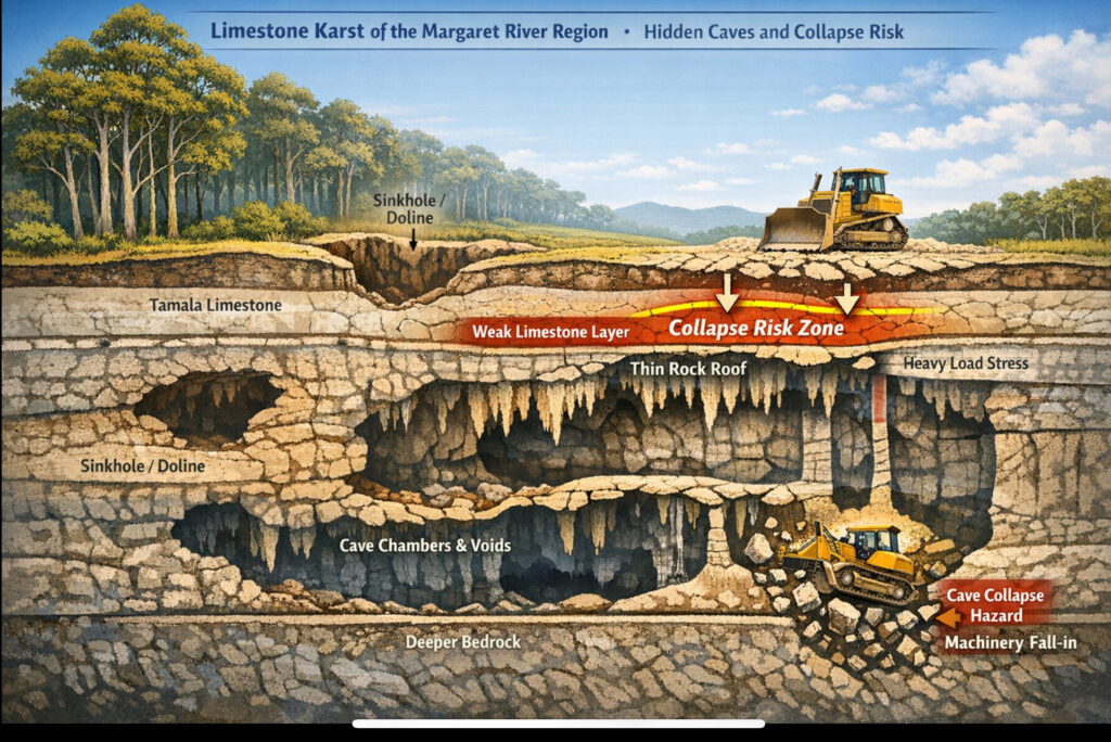
Large areas of the Leeuwin–Naturaliste Ridge are underlain by limestone karst — a complex system of caves, voids, solution pipes and subterranean chambers formed over thousands of years. While the surface may appear stable, the rock below can be highly variable, with thin limestone “roofs” spanning underground cavities.
In these landscapes, the unseen matters.
Why heavy machinery isn’t always an option
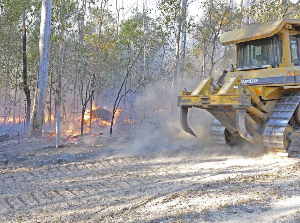
In limestone country, the use of heavy earthmoving equipment such as bulldozers and excavators can be restricted — or avoided altogether. The reason is simple, but serious:
Heavy machinery can overload weakened limestone, punch through into hidden cavities, and collapse into the void below.
From an operational perspective, this creates:
- Significant life-safety risks for plant operators and firefighters
- Highly unpredictable ground conditions, even where the surface appears intact
- Practical limits on traditional mineral-earth firebreak construction
In some areas, these risks are sufficiently high that machinery use is formally constrained — not only to protect people, but also to avoid irreversible damage to fragile cave systems.
What this means for bushfire strategy
Where heavy machinery cannot be safely used, bushfire suppression must adapt. Firefighting strategies in karst landscapes rely more heavily on:
- Existing roads and tracks as primary control lines
- Hand-built firelines in carefully selected locations
- Planned backburning from established edges, when conditions allow
- Increased reliance on aerial suppression
- Local knowledge of known cave and karst systems to guide safe operations
These constraints can make fires more complex and slower to contain — not because of fuel or weather alone, but because the ground itself limits how firefighters can engage.
Why this matters for planning and design
For Blackash, this is a powerful reminder that bushfire risk is not just about vegetation and fire weather.
Geology, landform and what lies unseen beneath the surface can materially influence:
- Emergency access and suppression capability
- The feasibility of mitigation measures
- How bushfire risk should be assessed and managed at a strategic level
Understanding these operational realities is critical when planning development, infrastructure or emergency management in limestone and karst landscapes.
Bushfire behaviour starts above ground but effective bushfire management demands an appreciation of what’s happening below it too.


