




Bushfire Attack Levels
Know your BAL. Understand what it means.
Your Bushfire Attack Level (BAL) can have a significant influence on how and where you build.
Blackash provides site-specific BAL assessments to determine the potential level of bushfire exposure and help clients understand the implications for building design, construction materials and development approvals.
We provide clear, reliable advice to help homeowners, builders, architects and developers make informed decisions from the outset.
What is a Bushfire Attack Level?
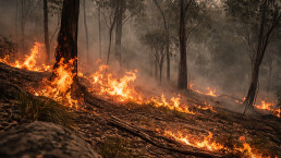
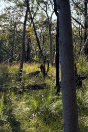
A Bushfire Attack Level measures a building’s potential exposure to ember attack, radiant heat and direct flame contact during a bushfire. The BAL classification is determined by factors including surrounding vegetation, distance from the hazard and the slope of the land.
In Australia, the recognised BAL classifications and level of exposure are:

BAL-LOW
Very low risk of bushfire attack
BAL-12.5
Ember attack and radiant heat up to 12.5 kW/m²
BAL-19
Ember attack and radiant heat up to 19 kW/m²
BAL-29
Ember attack and radiant heat up to 29 kW/m²
BAL-40
Increasing likelihood of flame exposure and radiant heat up to 40 kW/m²
BAL-FZ
Direct exposure to flames from the fire front
The assigned BAL informs applicable construction requirements under Australian Standard AS 3959 and the National Construction Code.


Frequently asked questions
Understanding bushfire risk and what it means for your property, project or organisation isn’t always straightforward. Here, we answer some of the questions we’re most often asked and provide a clear starting point for navigating the issues. Visit our FAQs page for more.
Bushfire-prone land is land that has been identified as potentially exposed to bushfire risk. In NSW, bushfire-prone land is identified through Bush Fire Prone Land mapping prepared by local councils and certified by the NSW Rural Fire Service. Being on bushfire-prone land does not necessarily mean development cannot occur. It means bushfire risk and the relevant planning and building requirements need to be considered as part of the development process.
BAL stands for Bushfire Attack Level. It describes the potential level of exposure of a building to bushfire attack, including ember attack, radiant heat and direct flame contact. BAL classifications range from BAL-LOW through to BAL-FZ (Flame Zone). The applicable BAL can influence construction requirements and the materials and design measures required for a building.
A BAL assessment considers factors including surrounding vegetation, the distance between vegetation and the proposed building, the slope of the land and other site characteristics. Because these factors can significantly affect the outcome, a site-specific assessment is important when planning development in a bushfire-prone area.